 Land subsidence due to groundwater overdraft in the Central Valley has caused a 1200 square-mile subsidence bowl, reducing the capacity of water delivery and flood control infrastructure, USGS researchers said in a news conference last week.
However, the discovery of such a large depression was not the only surprise for the researchers. “We were also surprised the high rate of subsidence,” said USGS hydrologist Michelle Sneed. “About 11 inches a year – nearly a foot a year – is among the fastest rates ever measured in the San Joaquin Valley, so this is similar to some of the rates that were measured in the 50s and 60s before the California Aqueduct became an available water resource.”
Groundwater overdraft and subsidence in the Central Valley is certainly no secret; a USGS study in the 1970s found that groundwater pumping between 1926 and 1970 had caused widespread compaction of the aquifer and land subsidence that exceeded 28 feet in some areas. Surface deliveries in the 1970s resulted in some recovery of groundwater levels, but in periods when surface water deliveries are reduced, farmers turn to groundwater.
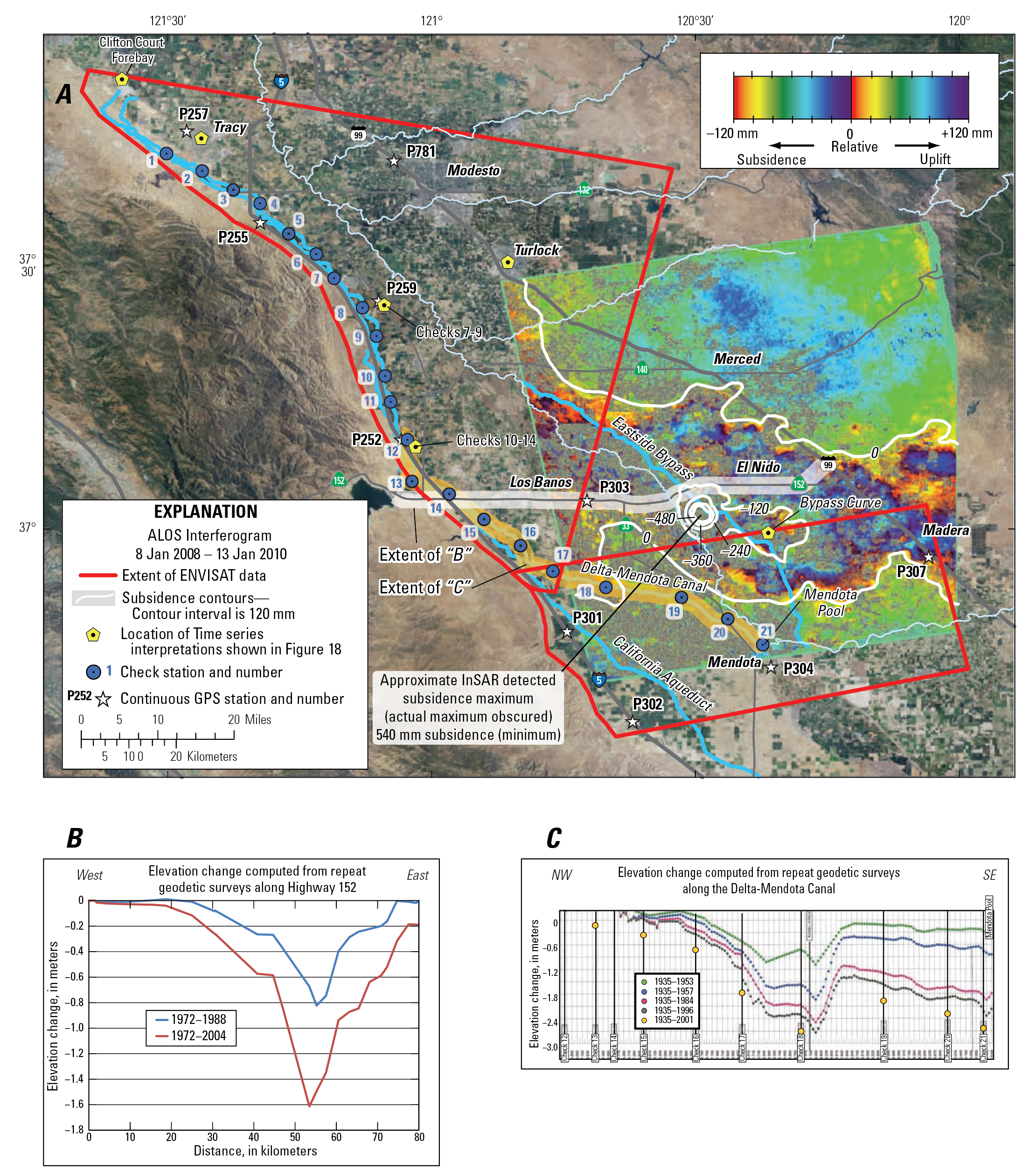
A) ALOS interferogram with subsidence contours showing vertical changes in land surface in the central San Joaquin Valley area, California, during January 8, 2008–January 13, 2010, (B) graph showing elevation changes computed from repeat geodetic surveys along Highway 152 for 1972–2004, and (C) graph showing elevation changes computed from repeat geodetic surveys along the Delta-Mendota Canal for 1935–2001. Subsidence data along Highway 152 were computed from published National Geodetic Survey elevations. Subsidence graph along the Delta-Mendota Canal was obtained from the San Luis-Delta Mendota Water Authority and the Central California Irrigation District
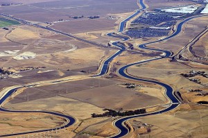
Satellite imagery indicated that the roughly 1200 square miles bowl is centered around the Central Valley town of El Nido in Merced County, and includes part of the San Joaquin River and most of the Eastside Byapss which is the primary flood control channel east of the River, as well as several other water conveyance structures.
Controlling the problem is difficult in a state which lacks any regulations or controls on groundwater use. While many of the urban areas overlying groundwater basins are either adjudicated or otherwise controlled by groundwater management plans, the Central Valley, as well as other areas of California, remains managed by local entities, if at all.
“The solution is to stop lowering groundwater levels, but that’s not an easy thing to do,” said Sneed. “It’s really more of a question of managing the problem, of measuring the subsidence, of measuring the groundwater level changes, and providing that information to engineers so that they can work with it. If we don’t have the measurements, if we don’t have the data, then engineers don’t know what they are up against.”
The study was commissioned by the Bureau of Reclamation in order to learn about the effects of subsidence on infrastructure in the area after damage was found to the Delta Mendota Canal. The study determined that the subsidence rate had doubled in 2008 in areas around the canal, coinciding with water levels in many deep wells in the area reaching historic lows. Scientists say the damage is likely permanent, even if groundwater levels recover.
“The amount and widespread nature of the subsidence found by the USGS is truly alarming and shows that cutbacks in surface water deliveries because of drought or environmental concerns cannot sustainably be replaced or exceeded by continual groundwater extractions,” said Phil Isenberg, Chair of the Delta Stewardship Council. “
He called on local agencies to develop sustainable groundwater plans, suggesting state action might be necessary in the absence of action. “If local or regional agencies fail to develop and implement these plans, the State Water Resources Control Board should take action to determine if the continued overuse of a groundwater basin constitutes a violation of the State’s Constitution Article X, Section 2, prohibition on unreasonable use of water and whether a groundwater adjudication is necessary to prevent the destruction of or irreparable injury to the quality of the groundwater, consistent with Water Code sections 2100 and 2101.”
For more information:
- Click here for the USGS Report, “Land subsidence along the Delta-Mendota Canal in the northern part of the San Joaquin Valley, California, 2003-10.”
- Click here to read what hydrologist Michelle Sneed had to say about the study she led at the press conference.
Written by Chris “Maven” Austin
You must be logged in to post a comment.